Zoning Code Information
To view the current zoning codes, click here to view Chapter (Part) Eleven of the City of Marion's Codified Ordinance for Planning and Zoning.
For specific Zoning Use Code information on parcels (land or lots), use the link listed below to access Marion County Auditor GIS webpage.
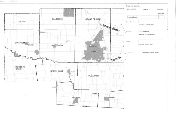
Go to http://mcogis.co.marion.oh.us/mapping/ to search for Zoning Use Code information by parcel (property/land). Once on the GIS webpage, do the following:
Instructions for locating Zoning Use Code on GIS webpage
1) TYPE IN ADDRESS of the location in which you are wanting to obtain the zoning information in the “Address” search box. (You must enter the house number and at least a portion of street name). PRESS SEARCH.

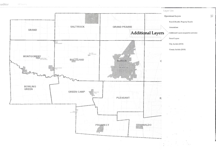
2) Once search has located property, PRESS LAYER LIST BUTTON  at top of screen (resembles a stack of papers) and this will reveal a list of Operational Layers checkboxes.
3) After checkboxes are revealed, PRESS “ADDITIONAL LAYERS” to reveal more checkboxes.

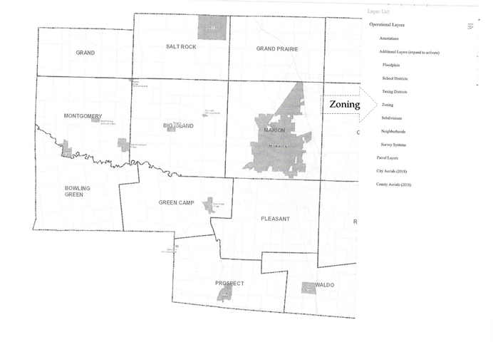
4) At this point, PLACE CHECK (Ö) IN BOX BESIDE ZONING and then close the Layer List Box by PRESSING “X” at top right corner.

5) The Zoning Code for the parcel (property/lot) you performed a search on will now be shown in red.

Zoning Code Descriptions for the City of Marion
Residential Districts
R-1A Single-Family District, Low Density
R-1B Single-Family District, Medium Density
R-1C Single-Family District, High Density
R-2 General Dwelling District
R-3 Multi-family District
Office Districts
O-I Office and Institutional District
O-I-A Office – Institutional – Apartment District
Commercial Districts
C-1 Neighborhood Shopping District
C-2 Community Shopping District
C-3 Central Core Business District
C-4 Central Frame Business District
C-5 General Business District
Industrial Districts
I-1 Limited Industrial District
I-2 General Industrial District


